


A 15 Hour Vacation
Twenty days ago, My brother, his wife and I, headed up to Lake Superior. Making a day of wandering along the northern coast. I had never been up there in the winter months and was quite curious about what much of it would look like. We started by chasing waterfalls. Figuring we would go to the most northerly destination first and make our way south from there. We arrived at stop number one and proceeded to be very underwhelmed, the falls were a mass of ice without any detail, or interesting ice formations at all. Ok, that’s fine, let’s hit My favorite waterfall next! A ten minute drive and a short hike later, we arrived! But, it was also a bit of a let down… The ice was not very photogenic. Realizing that the best Ice shots were probably to be had early in the winter, as opposed to our venture near winter’s end, we wandered back towards the car. Instead of taking the trail, we walked on the river. Which turned out to be very memorable! All was well for the first half of the stroll, but then we started encountering some pretty thin sounding ice. My sister in law being pregnant and carrying five thousand dollars in camera gear myself, we departed from the river walk and scrambled back up the hill to the trail. It was pretty rad walking on water though, even if it led to much anxiousness and a bit of fear..
")
")
")
")
")
")
")
After that, we made our way back towards the south. Pausing for a quick view of this rock beach that I had visited with a friend last year. It is actually private property, but I was a bit suprised to see that there was no sign of humans there. Clearly, this place was actually owned by deer. Who had left plenty of tracks in the snow… There were some pretty cool frozen rock walls, held together by ice. Some spots had a four or five foot overhang. It was pretty neat, especially because of the icey build up on the southern point in this miniature bay.
")
")
")
")
")
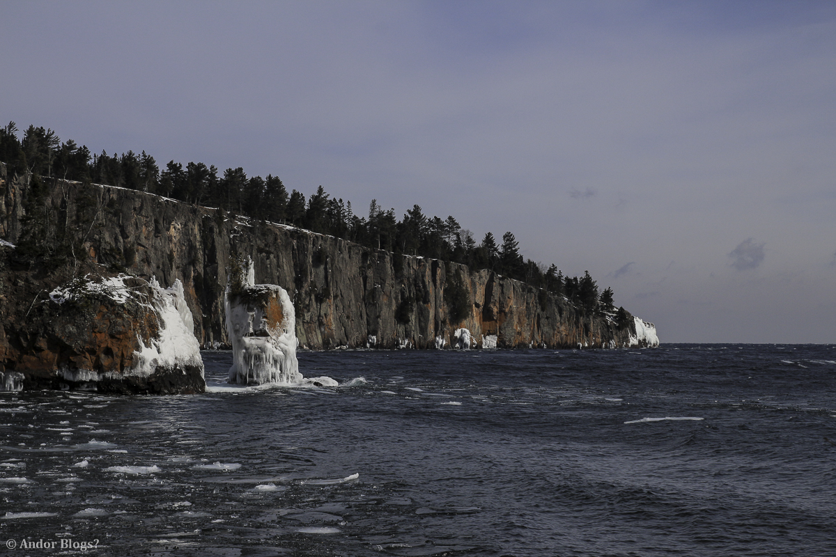
Then, we stopped at Tettegouche State Park. The crown jewel of the state parks system here in Minnesota. Opting not to bother with the hike inland to the falls, we stayed along the coast and were dazzled by the ice built up around the shore line. Many pictures were taken, much time passed by and just like My previous visits to this park, I did not want to leave…
")
")
")
")
")
")
")
")
")
")
")
")
")
")
")
")
")
")
")
")
")
")
")
")
")
")
")
")
")
")
We did leave this wintery wonderland though. The pregnant one among us was getting pretty tired. So we stopped at Palisade Head, where I took a lonely walk up to the the high ground. Pausing to take a shot of the communication tower piercing through the bold sun dog above, I made it to the overlook. What a view! You can see the southern quarter of the rolling hills to the north and the endless glitter of Lake Superior to the south. It was by far the easiest hike of the day and yielded one of the most spectacular perspectives on the north shore…
")
")
")
")
")
")
")
")
")
")
")
")
")
")
Continuing south towards Duluth, we made one more stop. So I could take some pictures of the light house at Split Rock. Unlike anywhere to the north, the bay was mostly iced over. Having walked down a river of ice a few hours earlier, I started My way out to the edge of the bay, walking on the lake… There is an island a couple hundred yards out. I noticed some people were on the island and also made note of the many lines of foot prints in the thin snow all around the bay. The ice was pretty thick, so I was quite confident as I wandered towards the spot where one can take a picture with the island and light house together. About a third of the way there however, there was a cracking sound and the ice shifted under My feet. Not by much, maybe an inch and a half, but I watched a crack form, a foot or so to the side of Me that stretched all the way out to open water. Heartbeat increasing to a rapid pace, I hopped over the crack. Which was inbetween Me and solid ground and hurried off the ice.. I then snapped a couple shots of the light house and neglected to make it out to the planned location of shooting. Adrenaline flowing, I walked the path back to where My brother and his wife were waiting and we departed.
")
")
")
")
We made a pit stop in Duluth to fill our bellies. Then decided there was still time for another stop. My brother and I were both curious to see Jay Cooke state park. We had camped there a few years ago, but wanted to see what it looked like now. The reason for this curiousity is that two years ago, a damm just up stream from the park broke. Sending a gnarly torrent of flooding southward in to the park. It washed away the bridge that is the only real access to the camp sites and many miles of hiking trails. The water was super low compared to our previous visit and there was a spiffy new bridge over the river. If there were any other real differences, they were hiding under ice and snow..
")
")
")
")
")
")
")
")
")
")
")
")
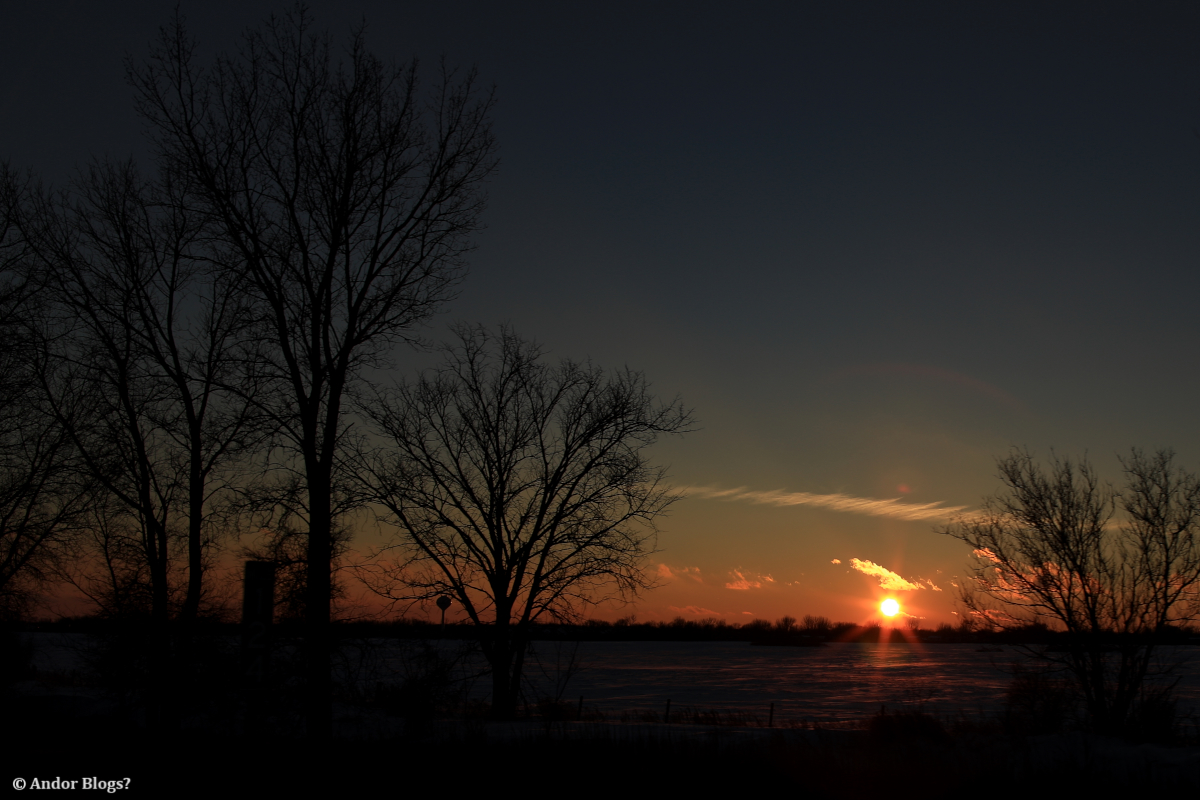
With the sun sinking in the sky and home being over two hundred miles away, we hopped back in the car and made our way south toward the Twin Cities. Quite the successful day trip! We even got to enjoy a pretty lovely sunset as we cruised down the interstate, on our way home…
")
")
")
")
")
")
")
")
")


My First 6 Months of Time Lapsing
Yep, I made a video! There’s a first time for everything… The first three quarters took Me about 2 hours to patch together, from clips made after each time I shot a sequence. The song took a couple days of semi-inspired attention. The last segment of the video however, took 3 weeks to edit. Mostly because I used StarStax to make 5 versions of the sequences. Then, I had to pluck the right spots from those in small chunks, reverse the numbering order on half of them, make videos of each of those sections, then finally patch them all together and time them to the music. The result? Dancing stars! Watch through the end and see what I am on about..
As with all the vids on this blog, it is hosted for free by Vimeo. So it is of low image quality, watching it on their site does look slightly better than watching it here… So sad, because it looks awesome in 4K! Vimeo also neglected to keep the music synced with the video! :( No wonder I refuse to pay them a penny!
")
")
")
")
")
")
")
")
")


")
")
")
")
")
30 Hour Vacation
I bought a Canon 6D and their 24mm f/1.4 L series lens to go with it. Anxious to make use of these new toys, I started asking around to see if any of My friends wanted to go camping. An old friend that I rarely talk to opted in, along with Her husband and three dogs. The morning of departure, I shot them a text to see if they were running on schedule. The reply was, “We have to cancel.” Her family rents out a few houses around the neighborhood, one of which was to get new tennants after the weekend. The person who had lived there decided to leave the place packed full of crap, clutter and furniture. It looked like a pack rat was living there. Hell bent on getting out of the city, I met up with them and we had the place mostly empty in under three hours. Happily, we then proceeded to get in the van and drive north. It was already after noon on saturday, but in My book, any time outside of city life is time well spent. It was a lovely drive, just south of Lake Superior’s western-most point, we encountered a thick fog. These pictures do not do it justice, one could barely see a hundred yards for a good twenty miles.
")
")
")
Just south of the lovely town of Duluth, the fog lifted and my friends, who had never been to this part of Minnesota, could see why I love this little city, perched on a hill. The place has an unusually elaborate system of bridges. Partially due to the fact that this is a busy port town, but that still does not explain why the highway has so many bridges, crossing, rising and bending in every which way. Duluth has so many great angles and lines built in to it’s infrastructure. Some time soon I think I shall head up there, just to photograph the genius of those who designed and built the city. Passing through, I snapped a couple of shots through the dirty windows on the car.
")
")
")
For those of us from the Twin Cities, Duluth is the gateway to the north shore. Once You have passed through town, You find Yourself on the red road. The red tarmac doesn’t last long, but is a much welcomed sign that You have left the urban environment behind. From that point, heading north-east along Lake Superior’s coast, is a long, long stretch of rolling hills, rocky shores, winding rivers and endless forest. My favorite place to be! We headed up the coastal road passing through the many State Parks and National Forests. Eventually finding ourselves at Cascade State Park, which is a little more than an hour from the Canadian border. It was already pretty late in the day, but we rapidly set up camp and got a fire going. After filling our bellies, we walked the couple hundred yards over to the lake and spent about two hours just sitting, taking in the vast darkness. It was a foggy night, visibility was quite low, but the sound of the waves rolling onto the rocky shore was just what I needed.
")
")
")
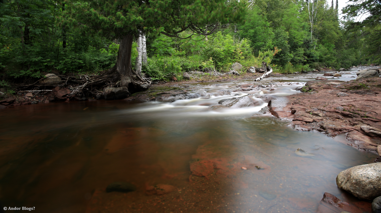
Once back at our campsite, we all went to bed pretty quickly. In the morning, we took a walk up the Cascade River, pausing for Me to take the following pictures and proceeded to head south, Hoping to make a couple of stops along the way back home.
")
")
My friend has a bad back, which chose to throw Him into a state of agony on this trip. I felt bad that He was in so much pain, so we took it easy on the return trip. In the end, we passed by all but one of the sights that the North Coast has to offer. I simply would not come up here without a stop at that which has become My favorite waterfall. Which I took a bunch more pictures of.. The overcast sky made taking pictures a lot nicer than the bright, sunny day the last time I was there. I took My time, stopping every couple hundred yards, pondering the angles I desired and taking more pictures, long exposures, all the way up the valley. The place was nice and quiet, we only saw two other groups of people the whole time we were there. What a wonderful place.
")
")
")
")
")
")
")
")
")
")
")
After basking in the cool water for a while, we climbed back into their van and headed towards home. Driving back down the coast, leaving behind the natural beauty of this post-glacial landscape and entering the land of human civilaization. The farther south You go, the impact of man kind becomes more and more evident. The lone road gets wider, sparcely placed houses give way to towns, tunnels bring You under towering rocky hills and eventually, You find Yourself looking at the ports and populated hills of Duluth. We paused there to stretch our legs and take a final look at the vast expanse of water, before climbing back into the van and continuing south towards Saint Paul. We managed to ride the leading edge of a storm for a couple hundred miles, all the way home. Arriving back in city life, just in time to see a very bold and beautifully colored sun set. Sorry, I did not get a picture of that, there were buildings in the way…
")
")
")
")
")
")
")
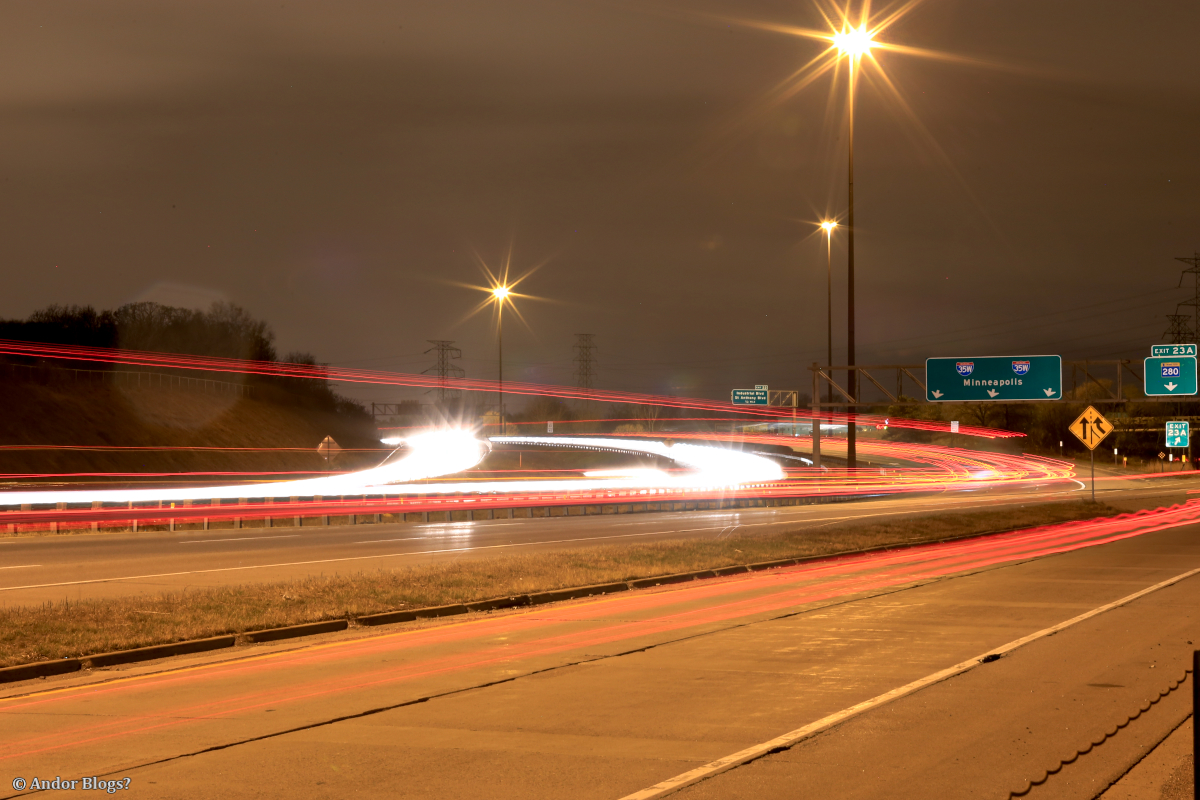
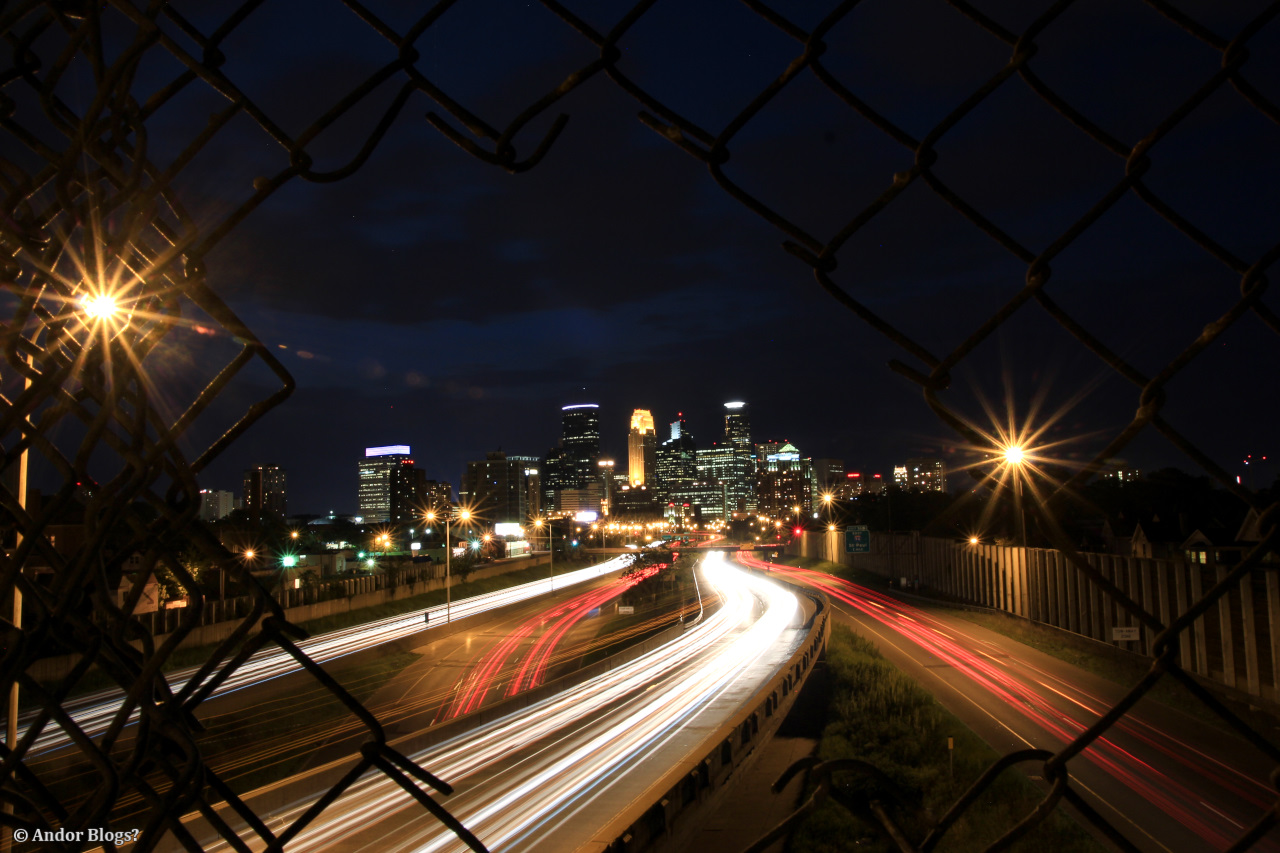
Rush Hour Traffic, By Downtown Minneapolis
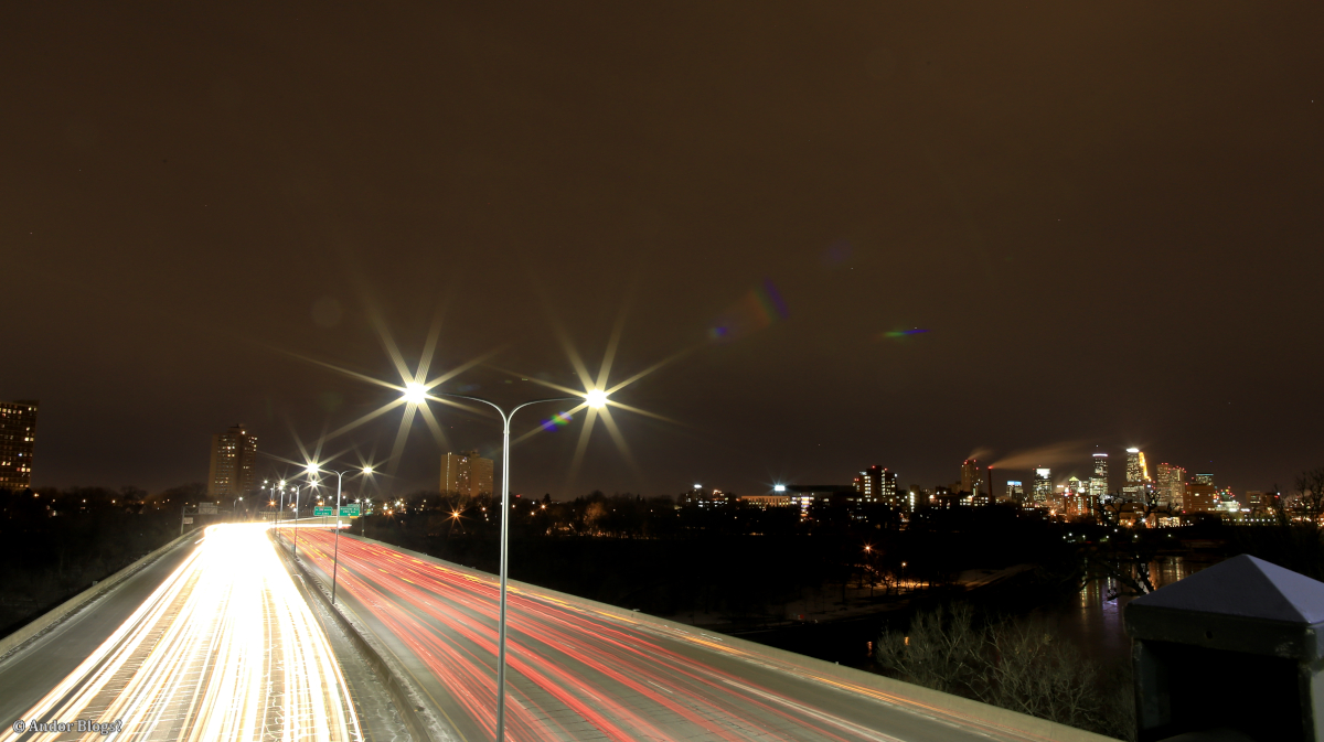
I went out to shoot some time lapse stuff with My friend Thai Phan Quang. We ended up on the walking bridge over 35W, a few bocks south of the I94 junction again. I am trying to stockpile a bunch of different time lapse series so I can eventually make a video which contains nothing but time lapsed segments. This is a single, 1500 image sequence from rush hour today. It lasts a little longer than 45 seconds. I was hoping for more cloud activity, but since there was very little, it seemed right to frame things just above the tallest buildings. The music is by My big Brother’s band: Heiruspecs. The song is ‘Snapshot’ off of their most recent album, Night Falls.
After shooting that sequence, I did some small perspective changes and adjustments. Going for a slightly different feel, by blurring the traffic a little bit. Then shot this twelve second set, consisting of 500 images. Hope You enjoy this silent, short one. Not in HD, because I don’t pay Vimeo and am limited to one, high quality upload per week.
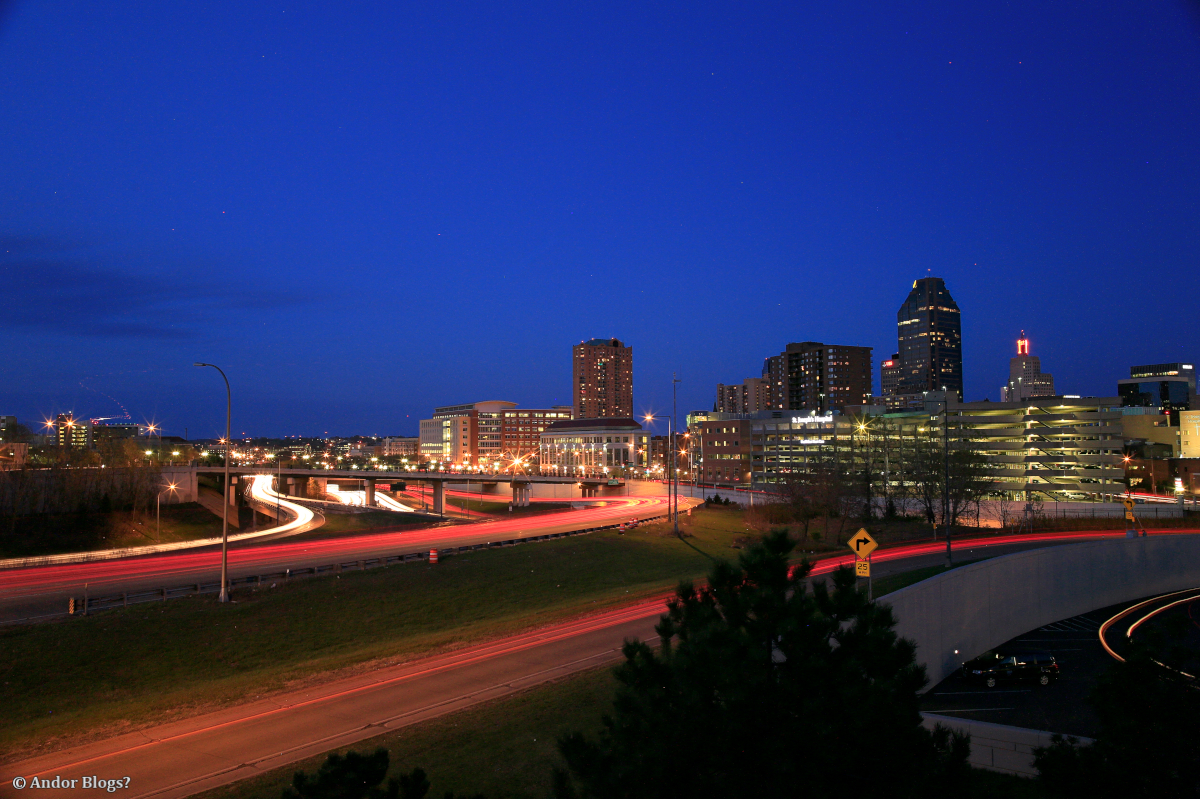
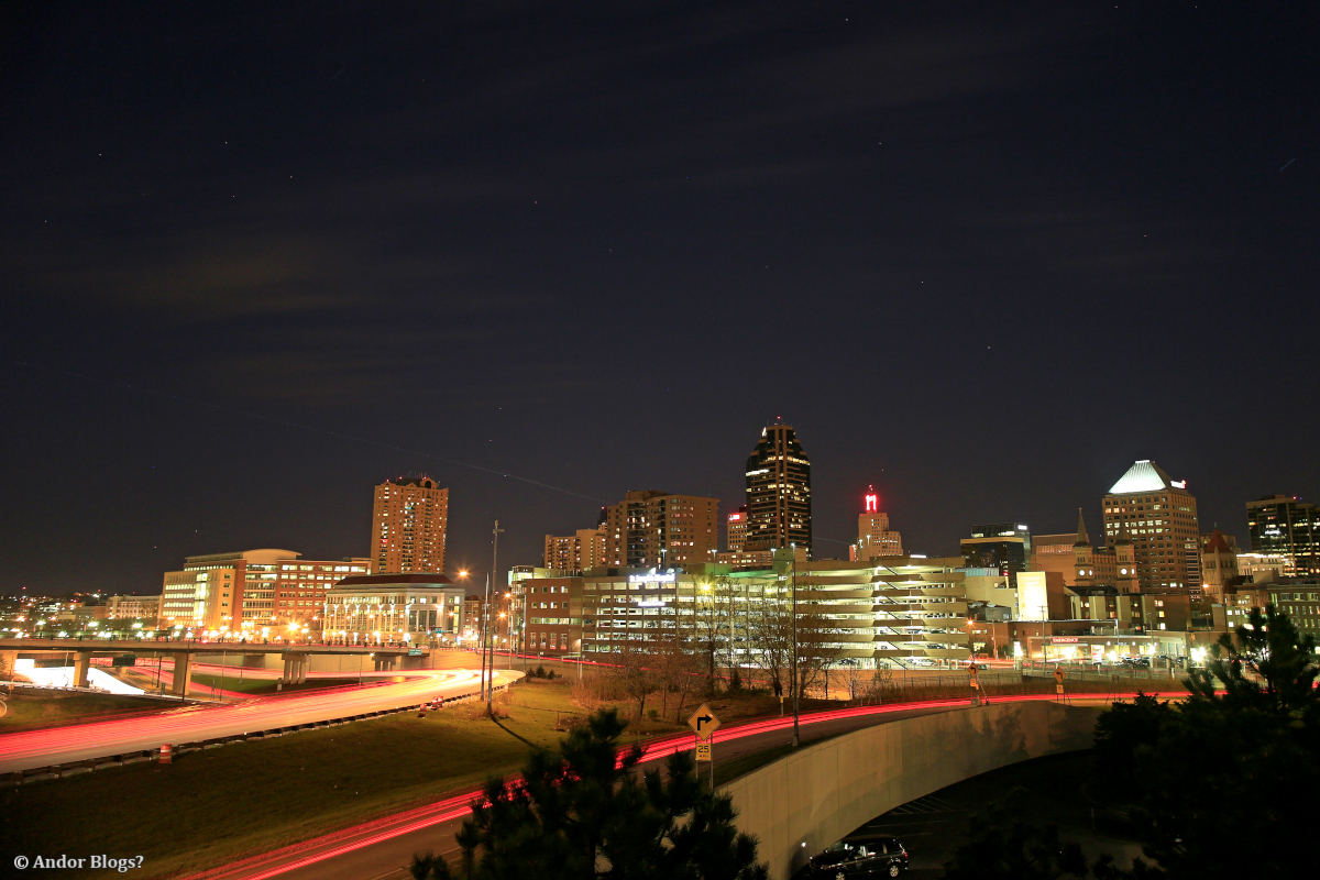
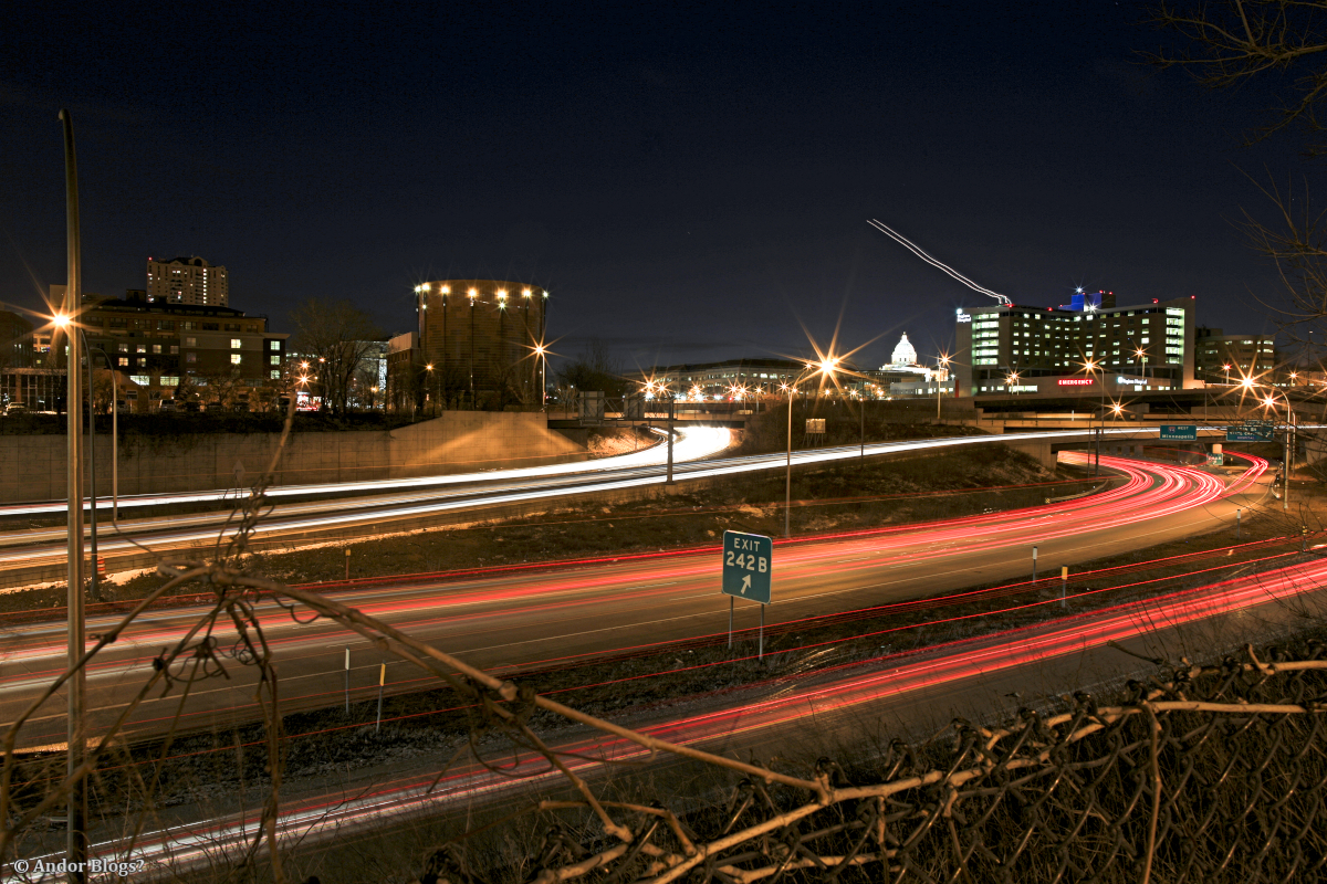
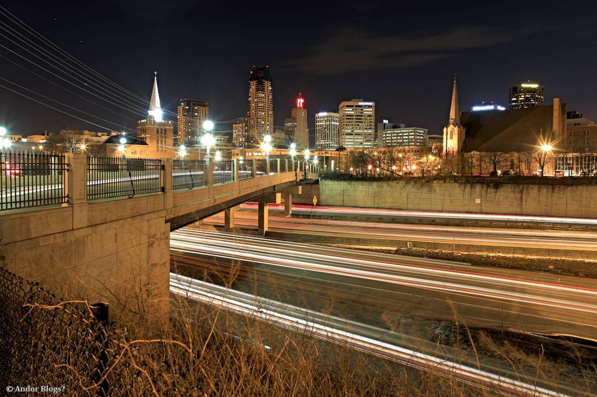
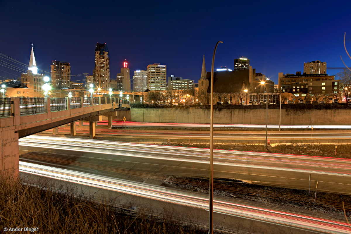
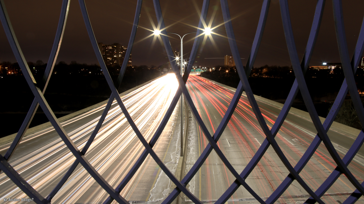
Urban Vibration
Last night, I went out with a friend who is in to time lapse photography. Which basically means You will be sitting in one place for a couple of hours. So, I set up My tripod and proceeded to take a bunch of long exposures. These pictures captured something more than just the lights of buildings and cars passing by. The lights of the vehicles revealed the vibration of the bridge upon which we stood. That bridge being a walk-way, maybe eight feet wide, spanning the ten lanes of traffic on I-35W, just south of the I-94 junction. It was pretty windy early on, but it was the semi trucks that were causing the bulk of the motion. You can see in the cropped image below, the effect of a large vehicle passing underneath. Head lights apear as if the highway was a row of small waves, with increased hight when a large truck goes by.

Despite the constant vibration and the rain early on, I came through with some decent shots of downtown Minneapolis. They are not a crisp as I would like, but the texture added to the streaking lights is kind of nice. A neutral density filter, which I usually do these kind of shots with, was not involved. I will try that spot again sometime, but clearly a more stable position to do long exposure shots with traffic and the city skyline is more desirable. This is a great vantage point though, there aren’t many places in town with such a nice perspective.
")
")
")

")
")
")
")
")


